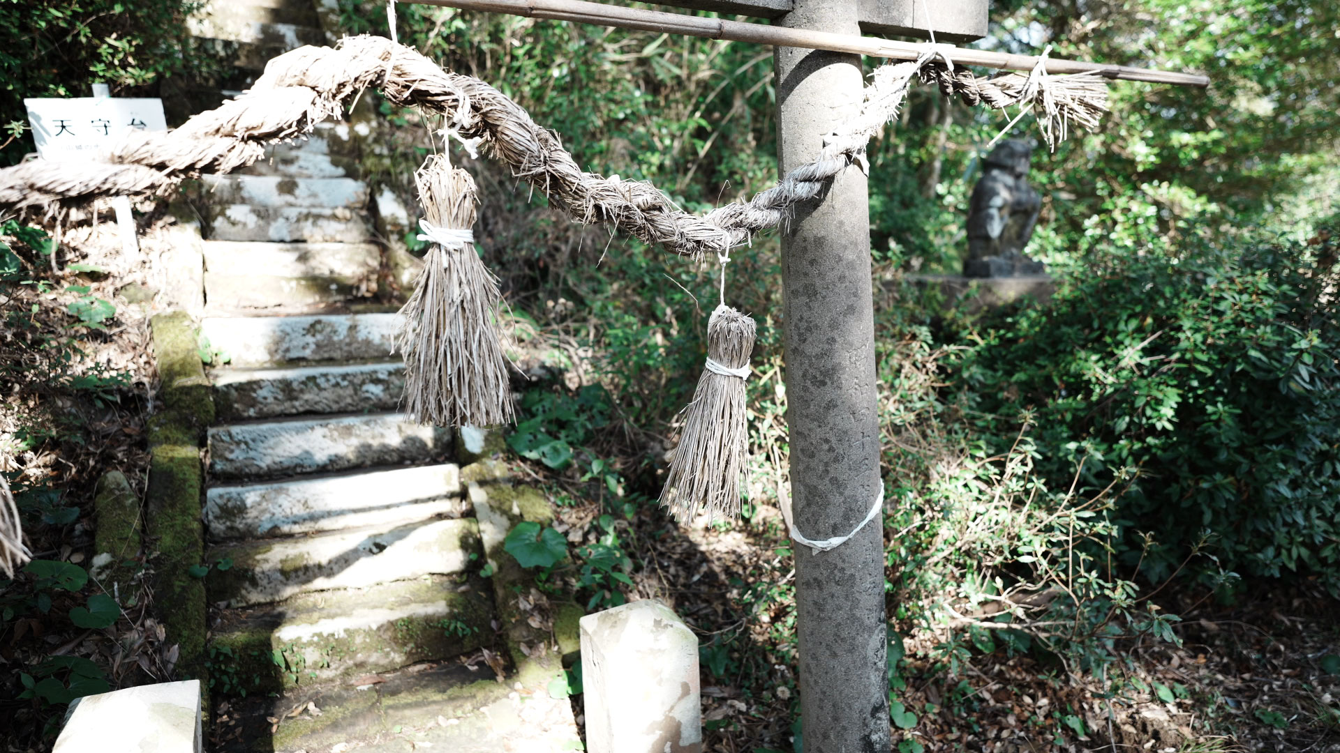
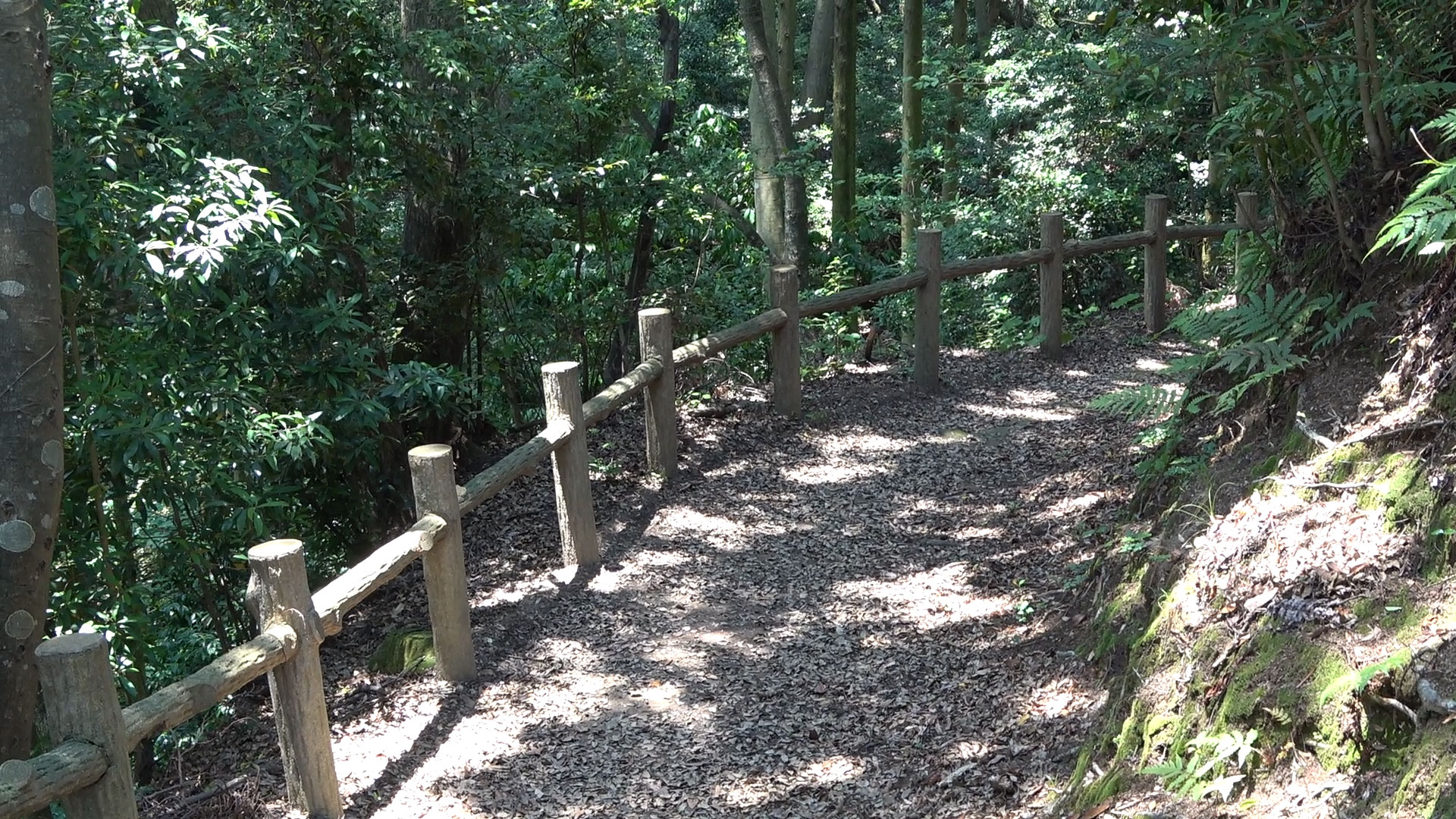
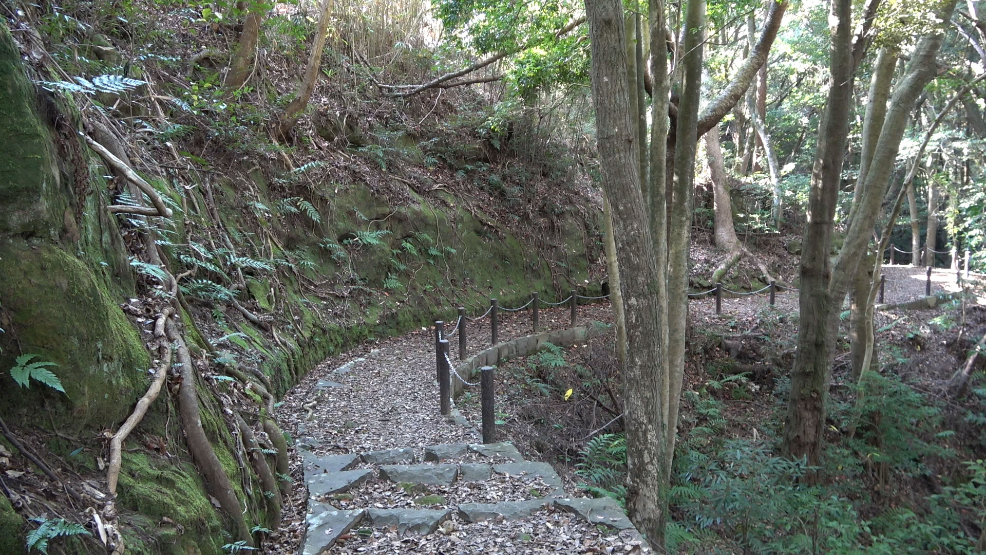
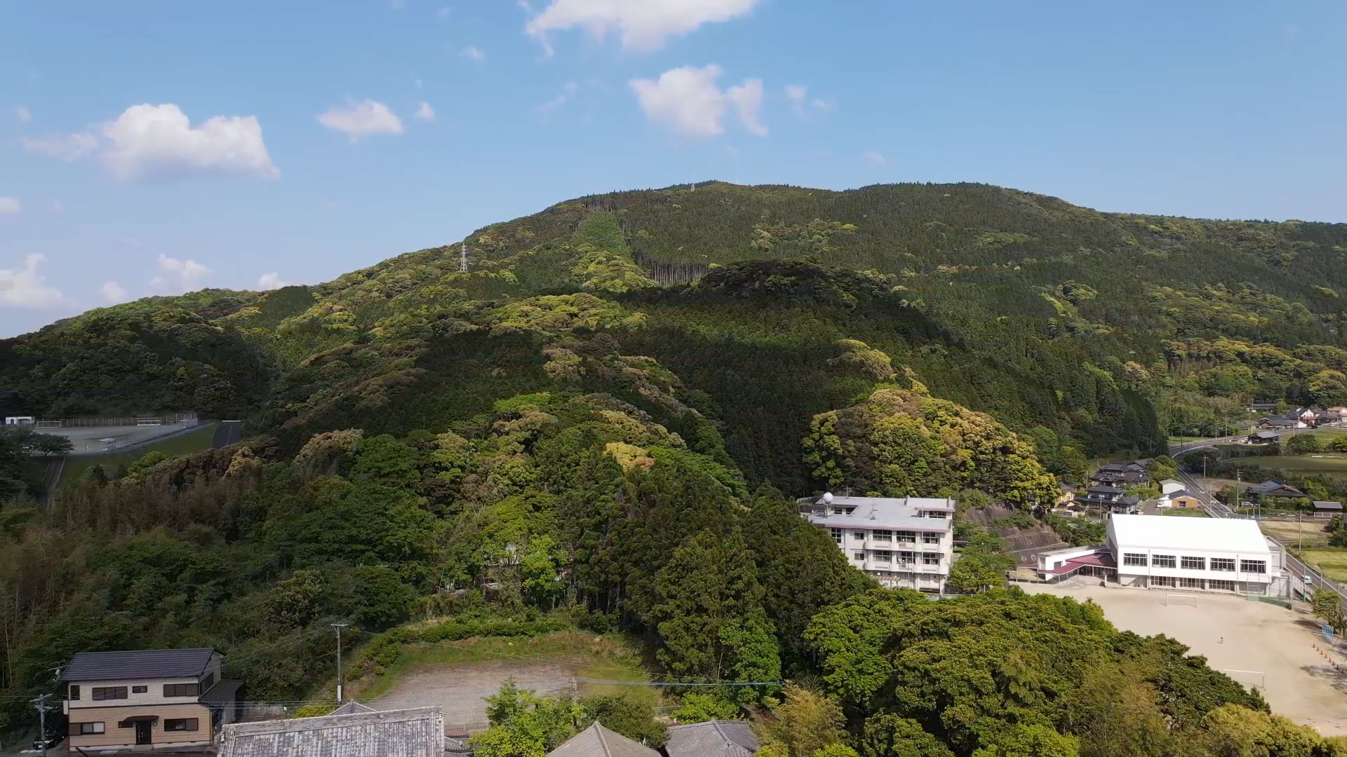
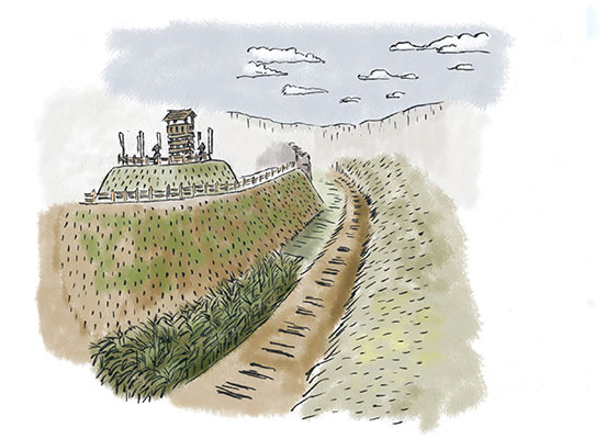
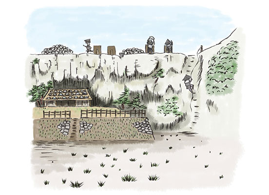
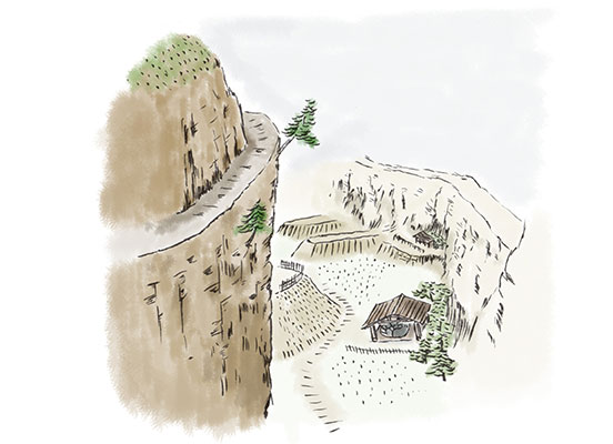
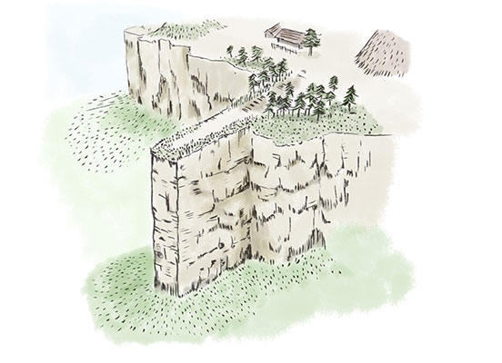
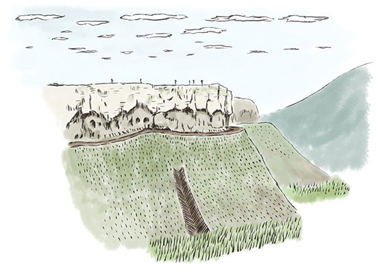
直谷城は、長崎県にある山城で、戦国時代の典型的な山城である。城の周囲を30mの断崖絶壁に囲まれており、遺構の保存状態が良い。
城の起源はいくつもの説があり定かではないが、戦国時代の半ば松浦党の一員志佐氏八代義(よろし)が山城としての機能を拡充し、それまでの志佐陣内から直谷城に本城を移したことが城の始まりと考えられる。
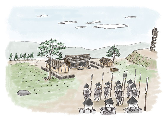
直谷城最後の城主志佐氏十五代の純髙は、豊臣秀吉の唐入り「文禄の役」で元禄元年(1592)に朝鮮で戦死し、主を失った志佐勢は戦国大名となった平戸松浦氏の旗下に属し、以後併呑される。
Naoya-jo Castle in Nagasaki prefecture is a typical mountain castle of the Warring States period. The castle is surrounded by the 30 meter high precipitous cliffs, and the archaeological remains are well preserved.
There are many legends about the origin of the Castle, but the actual origin is not yet certain. It is considered Naoya-jo castle began when Yoroshi of the Shisa clan (a member of the Matsuura Party) moved its headquarters from Shisa territory to Naoya-jo Castle by expanding its functions of the fortress as a mountain castle during the Warring States period.
The last castellan of Naoya-jo Castle, Sumitaka (the 15th lord of the Shisa clan) died in the battlefield of Korea in the 1st year of Genroku era (1592) when he joined Toyotomi Hideyoshi’s “Bunroku no Eki” (the first invasion to Korea). After losing the lord, the Shisa clan went under the lordship of the Matsuura clan of Hirado and joined them afterwards.
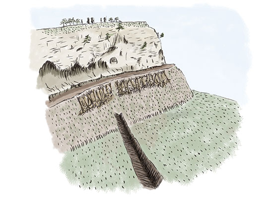
出 丸
城の南東部に突き出すように造られた曲輪。城の南東部からの敵襲に対し、最前線で戦うために造られている。
Demaru (Outer Bailey) – the defensive courtyard was built to stick out from the south-east part of the castle. It was built to provide front line defense against enemy attacks from the south-east side.
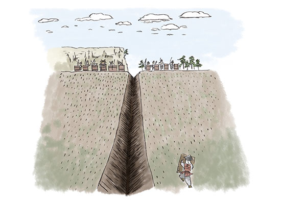
竪 堀(追手郭周辺)
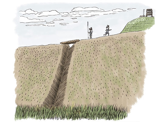
敵の出丸への襲撃を防ぐため、斜面に向かって縦方向に造られた堀。これにより、敵が横に移動しながら斜面を攻め上がりにくくなる。
Tate-bori (Vertical Moat around Entrance Enclosure) – a moat built vertically into the slope to create a V shape, which prevents the enemy from storming the Demaru (the Outer Bailey). This makes it difficult for the enemy to attack up the slope while moving sideways.
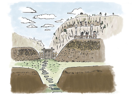
追手郭(四重の土塁・三重の空堀)
城の東部から追手道を上って侵入する敵を防ぐため、一の郭の南側の崖下にあたる防衛の重要箇所に4重の土塁と3本の空堀が設けられている。
Oute-kuruwa (Entrance enclosure with four earthworks and three moats) – Within the entrance enclosure, four earthworks and three moats are located under the cliff to the south of the first enclosure, which is an important defensive position to prevent the enemy from entering the eastern side of the castle.
武者溜り(追手郭下方東)
追手道の北側に、城の東部から追手道を上って侵入してくる敵を防ぐために設けられた兵士の駐屯場。
Musha-damari (Samurai Gathering Place) – a group of soldiers set up on the north side of the Oute-michi (Entrance Road) to prevent the enemy from entering from the eastern side of the castle.
武者溜り(矢石置場下方)
矢石置場から追手郭に降りた所、一の土塁の手前に武者溜りがある。城の東部から追手道を上って侵入する敵を防ぐために設けられた。
Musha-damari (Samurai Gathering Place) – There is a samurai gathering place near the arrows and stones storage place to come down to Oute-kuruwa (Entrance Enclosure), it is next to the first earthwork. This gathering place was set up to stop the enemy if they enter the entrance enclosure from the eastern side of the castle.
矢石置場
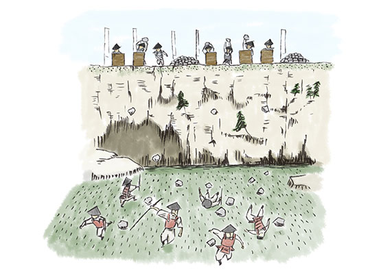
井戸を北東方向に見下ろす断崖上に、人頭大の自然石が集積されている。敵が南側の谷筋から攻め込んできた場合や、追手郭に侵入した場合、この石を投げて撃退する。
Yaishi-okiba (Arrows and stones storage place) – On the cliff overlooking the well in the direction of the northeast, the natural stones, the same size as a person’s head are accumulated. If the enemies attack from the valley line of the south side or if they come into Oute-kuruwa (Entrance Enclosure), these stones would be thrown to repel the enemy.
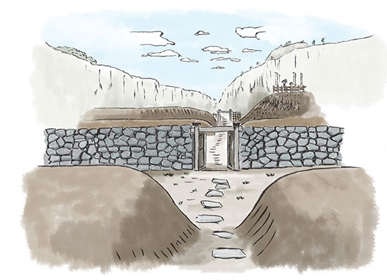
井 戸
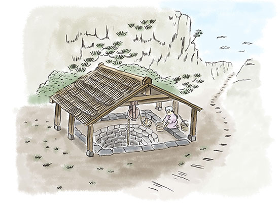
水の確保において重要な城内唯一の井戸。追手口から敵が侵入した場合、井戸を守るため4条の土塁と3条の空堀が造られており、さらに井戸の東西南北方向それぞれに武者溜りが設けられている。
Ido (Well) – The only well in the castle that is important for securing water. Four earthworks and three moats were built to protect the well in case the enemy attacks the castle from the entrance enclosure, and a samurai gathering place was set up in each direction of east, west, north, and south of the well.
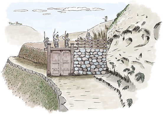
二の木戸跡
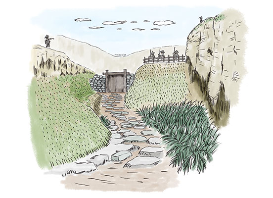
追手郭の西端、二の郭・一の郭に登っていく要所に門が設けられている。追手郭から二の郭・一の郭へ侵入する敵を防ぐ機能を持つ。
Ni no Kido (Second Wooden Gate) – There are gates on the way towards the first enclosure and the second enclosure if you are coming from the west end of Oute-kuruwa (Entrance Enclosure). These gates are to prevent the enemy from entering the first and second enclosures if they are coming from the entrance enclosure.
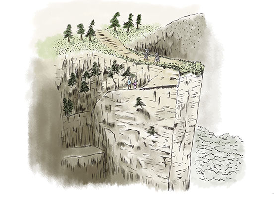
武者走り(一の郭南側下方)
一の郭と追手郭の間の断崖絶壁の中ほどに、井戸を見下ろす武者溜りがあり、そこまで移動するため東西に細い連絡通路、武者走りが造られている。
Musha-bashiri (Samurai Passageway underneath the south of the first enclosure) – a liaison path for soldiers when moving them from Oute-kuruwa (Entrance Enclosure) to the rear entrance and the rear wooden gate. The path is narrow and has dangerously steep, high cliffs on either side, requiring extreme caution when moving.
一の郭広場
追手郭の北側、急崖上に、北の姫落しの断崖、東の狼煙台、西の中央物見櫓に囲まれた城内随一の広さを持つ平場がある。多数の建物跡、陶磁器片や鉄釘などが発見されている。
Ichi no Kuruwa Hiroba (The First Enclosure Square) – It is the largest plane in the castle, on a steep cliff to the north of the Oute-kuruwa, surrounded by the Princess escape route to the north, the smoke signal platform to the east and the central watchtower to the west. Numerous building remains, ceramic shards and iron nails have been found here.
狼煙台(物見台)
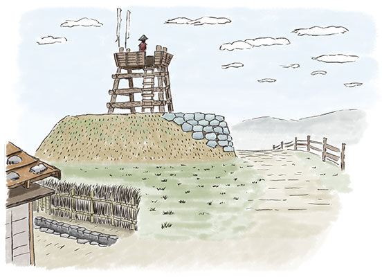
一の郭の東突端に一段高い土盛りがあり、城外の見張りが可能な物見台が置かれたと推定される。17箇所の柱穴や多くの陶磁器片などが発見されている。また、時期は不明だが1m幅の炭化物が見つかっており、ここで狼煙をあげた可能性がある。
Noroshi-dai / Monomi-dai (Smoke Signal Platform or Watch Mound) – At the eastern end of the first enclosure, there is a high earthen platform where it is thought that it was possible for samurai to watch over all the outside of the castle. In this place 17 pillar holes and many ceramic shards have been found. A 1 meter-wide carbonized item (the period is unknown) has also been found, and it is possible that smoke signals were raised here.
東突端断崖(眺望)
狼煙台の東は断崖絶壁となっており、物見岩から福井谷一帯を見下ろすことができる。
East Cliffs (Viewing Point) – To the east of the smoke signal platform is a precipitous cliff (Monomi Iwa / Rock of Watching), from which the whole Fukui Valley can be seen.
姫落しの断崖
一の郭の北に、幅4~5mで長さ20mほどの突き出し部があり、下は断崖絶壁である。落城を覚悟した城主が幼い姫を脱出させようとして失敗し、転落死させた伝説が残されている。
“Hime Otoshi Cliff” (Cliff of the Princess’ Fall) – To the North side of the first enclosure, a 4 to 5 meter-wide and about 20 meter-long protrusion is sticking out, with a sheer cliff below. A sad legend about this cliff has been handed down up to the present. Knowing the castle was about to fall, the lord of the castle tried to let the young princess escape from the cliff, but she fell to her death.
姫落し脱出ルート
「姫落しの断崖」から下へ、攻め登ることは不可能だが城内からの脱出が可能なルートが存する。
Hime Otoshi (Princess’ Fall) Escape Route – There is a route down from the “Hime Otoshi Cliff” (Cliff of the Princess’ Fall), which is possible to escape from the castle to the ground but is impossible for the enemy to climb up from the ground to invade.
中央物見櫓
一の郭の西、二の郭の東に、城外の見張りが可能な城内最高所がある。もともとは西側の二の郭から登る構造になっていたが、現在は東側に石段が付けられ頂部に内裏神社が祀られている。
Central Monomi-yagura (Watch Tower) - To the west side of the first enclosure and to the east side of the second nclosure,there is the highest place where is the best position possible to watch over the outside of the castle. Originally it was built to be climbed from the second enclosure on the west side, but now stone steps have been attached on the east side and the Dairi Shrine has been enshrined at the top.
二の郭広場
中央物見櫓の西に、一の郭に次ぐ広さを持つ平場がある。多数の柱穴、中国製陶磁器片などが発見されている。
Ni no Kuruwa Hiroba (The Second Enclosure Square) – West of the central watchtower, there is a flat area, the second largest in size next to the first enclosure. Numerous pillar holes and fragments of Chinese ceramics have been found here.
武者走り(岩立ち天端)
追手郭から搦手口・裏木戸へ兵士を移動させる時の兵士の連絡道。道幅が狭い上に左右は断崖絶壁となっており、移動には細心の注意を要する。
Musha-bashiri (Samurai Passageway on Top Edge of Iwadachi Rock) - It’s a very narrow passageway for the warriors to move the positions between the entrance enclosure and the back gates. It’s made in the middle of the cliff against the wall, and the warriors were required to pay extreme cautions to walk on.
武者溜り(搦手口)
城西部・搦手口・裏木戸を襲撃する敵を防ぐための兵士駐屯場。
Musha-damari (Samurai Gathering Place at Rear Entrance) – A group of warriors were stationed to prevent the enemy from attacking the western part of the castle, the rear entrance, and the rear wooden gate.
竪堀1(搦手口)
城の南西部・南部から搦手口・裏木戸に侵入する敵を防ぐため、斜面に向かって縦方向に造られた堀。
Tate-bori 1 (Vertical Moat 1 at Rear Entrance) – a moat built vertically into the slope of the mountain to prevent the enemy from entering the rear entrance and the rear wooden gate from the south-west and south of the castle.
竪堀2(搦手口)
城の北西部・西部から搦手口・裏木戸に侵入する敵を防ぐため、斜面に向かって縦方向に造られた堀。
Tate-bori 2 (Vertical Moat 2 at Rear Entrance) – a moat built vertically into the slope of the mountain to prevent the enemy from entering the rear entrance and the rear wooden gate from the north-west and west of the castle.
マップ(google map)
ルート案内(佐世保駅-直谷城)
■You Tuber 堀切凡夫さんによる直谷城紹介動画
堀切凡夫さんが直谷城を撮影するために訪問されたのは2022年5月。地元有志で毎年直谷城の整備・草刈りをしている時に偶然出会い、その後資料提供などを行いました。
最後に
■ 佐世保工業高等専門学校
令和4年10月、佐世保高専の1年生5名が中心となって「直谷城アーカイブ化実行委員会」が立ち上げられました。中世山城の特徴を示す遺構がよく残されている、佐世保市吉井町の直谷城跡の現地踏査を行い、デジタルマップの製作に取り組みました。城内に残されている土塁や竪堀、武者走りや武者溜りなどの各遺構について、スマホアプリを使って緯度・経度を計測し、その座標位置をグーグルマップに落としていく作業を行いました。このデジタルマップを公開し、地元の方々、日本人観光客の方々、さらに外国人観光客の方々まで、世界中に広く直谷城を知っていただき、現地に来て遺構を探索していただき、直谷城、佐世保市の良さを広く知っていただければと考えています。
In October, 2022, “Archiving Naoya-jo Castle Executive Committee” was established by 5 freshmen of Sasebo technical college along with other supporters.Naoya-jo Castle in Yoshii-cho, Sasebo is very famous for its well-preserved remains, which indicate the typical characteristics of the Mountain Castles in the Middle Ages. After visiting and investigating the actual ruin sites, making of the digital map of Naoya-jo Castle has begun.By using an application of the smartphone, the latitudes and the longitudes of each archeological remains (such as the mounds, the ascending trenches, the warriors pass ways, and the warriors battle spots) were carefully measured and were registered into a google map digitally. By making this digital map open to the public, we’re expecting the locals, the domestic and foreign tourists, and even the people around the world will get to know about Naoya-jo Castle.
■ 直谷城のアーカイブ化実行委員会
この事業は、「佐世保市文化・芸術プロジェクトのクラウドファンディング」でふるさと納税を通して寄付を募り、その資金を活用して実施することができました。
今回の直谷城のアーカイブ化事業で、より多くの方々に直谷城の事を理解していただくことができれば幸いです。
今後も、佐世保市の観光や街づくりに関する事業を実施していく予定なので、引き続きご支援のほどよろしくお願いいたします。
この事業に賛同して寄付を行っていただいた方々におかれましては、心よりお礼申し上げます。
また、この事業を行う機会を提供していただいた佐世保市さま、英訳作業にご協力いただきました佐世保南高校ESS同好会の皆様方にも心よりお礼申し上げます。
This project has been made possible by the funds raised at “Cloud Funding for the Projects of Sasebo City Cultures and Arts” through the system of the Hometown Tax Donation Program.
This project of archiving the contents of Naoya-jo Castle will hopefully make more people obtain deeper understandings of Naoya-jo Castle .
We are planning to continue the projects relating to the tourism and the development of Sasebo City; so, the continuous supports from you are greatly appreciated.
We would like to show our deep appreciation towards the people who understood and supported our project by precious donations.
We’d also like to give special thanks to the City of Sasebo for giving us the opportunity to do this project and to the ESS club members of Sasebo Minami High School for participating in translating the contents into English.